Range85-100
High confidence
Strong setup. Set the alarm and plan around it.
How Fog-Index turns atmospheric data into a single fog probability — the algorithms, the honest report card, and where the model is headed next.
Fog-Index helps photographers decide if an upcoming morning is worth the alarm, where to shoot, and what kind of fog scene to expect. Planning Context translates weather data into practical choices for viewpoint and composition.
Running advanced predictive models against global weather data is computationally expensive. To keep Fog-Index accessible and sustainable, the processing power is concentrated where it counts most for photography.
The model actively analyzes conditions during the morning Sunrise Window: Blue Hour at civil twilight (-6°) through the end of Golden Hour (+6°).
Exact local times vary by date and location.
Civil Twilight Start
Blue Hour begins at -6°.
Sunrise
Sun crosses the horizon at 0°.
Golden Hour End
Morning golden light wraps at +6°.
This is the core Fog-Index scale. Every forecast score lands in one of these four color tiers.
Strong setup. Set the alarm and plan around it.
Good odds. Worth the drive with a backup angle.
Borderline. Keep plans flexible and scout-ready.
Long shot. Stay in bed if you want fog.
Planning cues come after this score to help with composition and positioning. They add context, not points.
Fog-Index doesn't stop at “fog likely.” It helps you decide what the air will feel like, where to stand, and what light to expect. When a morning scores high, Planning Context translates meteorology into shot strategy — fewer blind alarm clocks, more intentional choices.
A surface-level read at your saved spot. It helps answer the in-the-soup question: barely there, cinematic layering, or full white-room risk.
An approximate fog-top altitude built from vertical atmospheric structure — pressure levels, humidity/cloud continuity, and inversion context. Your location's elevation is compared against the estimate to produce a viewpoint verdict.
Estimates the light quality above the fog deck by reading only mid- and high-level cloud cover. Low cloud is intentionally excluded because it's often the fog layer itself.
Start with a high-score morning. Then choose the workflow that matches what you want to make.
For forests, lakeshores, creeks, and intimate scenes where atmosphere and depth are the goal.
For peaks, ridges, lookouts, and city overlooks where the plan is to climb above the layer.
Forecast answers whether the next sunrise looks worth the alarm. Fog Seasonality answers when a place usually comes alive across the year. It turns the saved-locations dashboard into both a short-range forecast tool and a longer-range planning tool for photographers deciding when to book the drive, trip, or season.
Seasonality preview
Stacked likely + possible mornings
The default view stays broad and readable: stacked monthly bars showing how often a place lands in Likely or Possible territory across a rolling 10-year window.
Inside the location drawer, weeks reveal onset and tail-off that month averages can hide. That matters for places where the first week and last week of the same month feel like different seasons.
Seasonality is built from ERA5 archive data and a historical Fog-Index scorer variant. It keeps the sunrise-window philosophy and the same planning intent, but it drops live-only inputs so the historical layer stays stable, portable, and explainable.
Fog Seasonality is a historical average of fog tendency, not a promise for the coming season. A location can still miss in an unusually dry autumn or overperform in an unusually wet one. Use it to compare places and time trips, then use the live forecast to decide whether this week is the week.
Every region has a unique atmospheric fingerprint. Fog-Index works worldwide today, and was originally tuned and tested in the Pacific Northwest. The Fog Potential Map currently covers the continental US, while broader regional tuning and support for more fog regimes continue to expand. The algorithm runs two dedicated scoring pathways in parallel — one for radiation fog, one for advection (coastal) fog — and automatically picks the best fit for conditions at your location.
I believe you should know exactly where the model excels and where it's still learning.
| Fog Type | Current Algorithm Fit | The Honest Truth (Notes) |
|---|---|---|
| Radiation Fog | 🟢🟢🟢🟢🟢Excellent | The primary target. The model is perfectly tuned to detect the high-saturation, calm-wind, clear-sky cooling that creates these classic sunrise layers. |
| Valley Fog | 🟢🟢🟢🟢🟡4.5 / 5 | A core strength. Valley terrain bonuses, inversion-layer detection, and winter stagnation persistence make the model highly effective at predicting deep, persistent valley events. |
| Advection Fog | 🟢🟢🟢🟢🟡4.5 / 5 | Strongly improved in v2.3.0. The model now uses sea-surface temperature (air-sea delta) plus an upwind 3-ray marine fan with onshore/offshore wind checks. Remaining gap: performance still depends on marine data availability and sparse coastal sampling. |
| Upslope Fog | 🟠🟠🟡⚪⚪2.5 / 5 | Improved in v2.5.0. A conservative upslope mode now activates for ridge fallback transport when moisture and wind support lift, and it bypasses ridge and inland fallback penalties. Remaining gap: still heuristic and not yet a full terrain-relative forced-ascent model. |
| Precipitation Fog | 🟠🟠🟠⚪⚪Developing | Improved in v2.3.0 with a frontal fog gate (recent rain + rapid moistening + gust guardrail). Still heuristic: it captures many rain-driven setups but not full frontal dynamics. |
| Steam Fog | 🔴⚪⚪⚪⚪Poor | Requires data that isn't available yet: the specific temperature difference between cold air and warm water. The model will likely miss these localized events. |
Atmospheric physics change drastically based on geography. A model perfectly tuned for Seattle's stable valleys will fail wildly in a tropical environment.
| System Type | PNW, USA | Costa Rica |
|---|---|---|
| System Type | Stable Stratiform & Marine (Current Focus) | Dynamic Convective (Future Focus) |
| Wind | Calm (valley fog) or moderate onshore (marine fog) | Strong wind (pushing upslope) |
| Temperature | Cold ground temperature | Warm ocean air |
| Cloud Type | Flat, uniform cloud layer | Tall, puffy cumulus clouds |
| Formation | Valley fog needs calm, stable air and clear skies (radiative cooling). Marine fog needs onshore wind pushing moist ocean air over cold water. | Comes from unstable air, rapid uplift, and intense convective activity — fundamentally different physics. |
Conclusion: Even with our parallel pathways for marine fog, tropical and convective fog systems remain outside the model's reach. Conditions like orographic lift and warm-ocean convection that cause fog in other regions still need dedicated tuning.
Clear-sky cooling
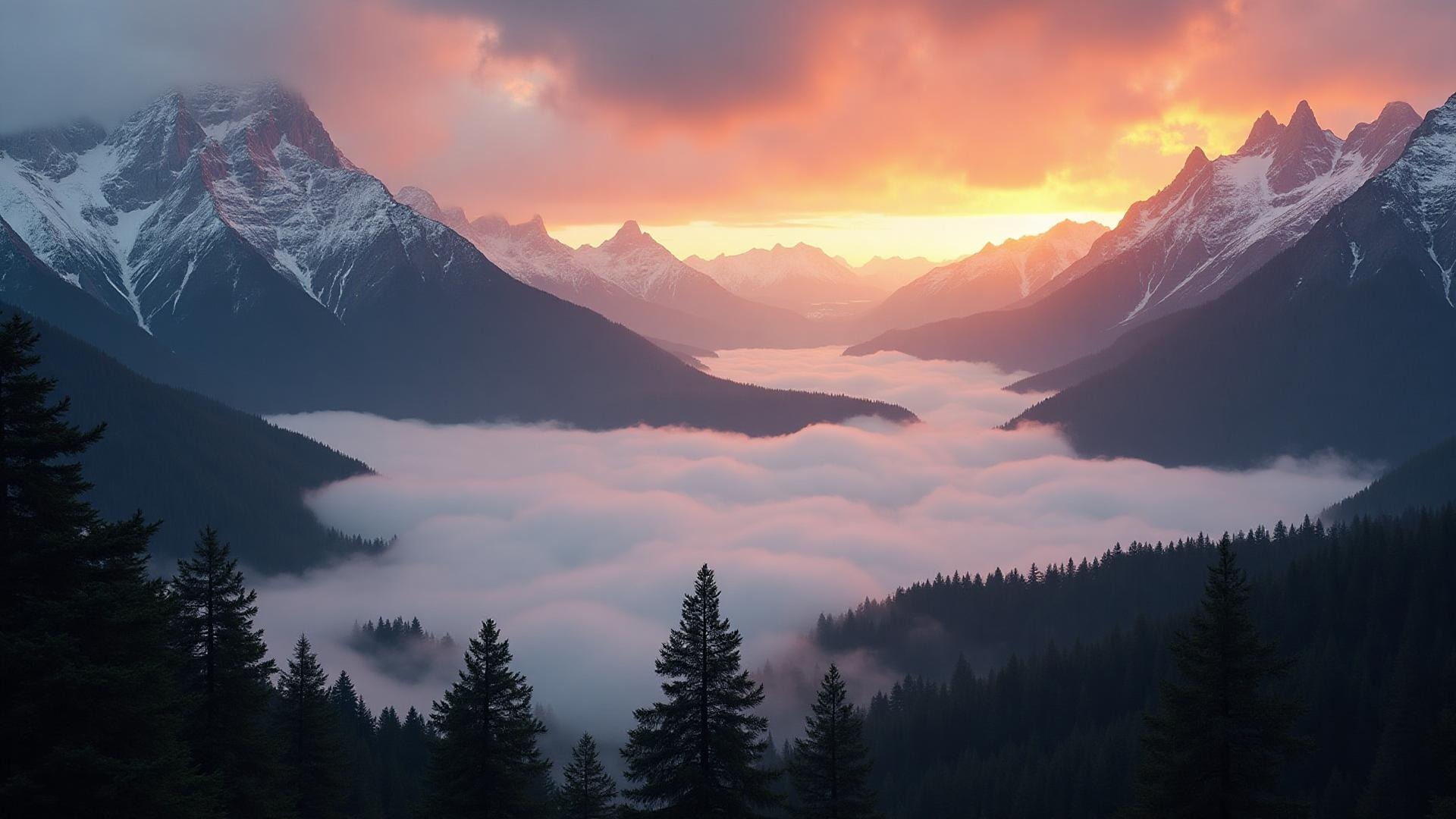
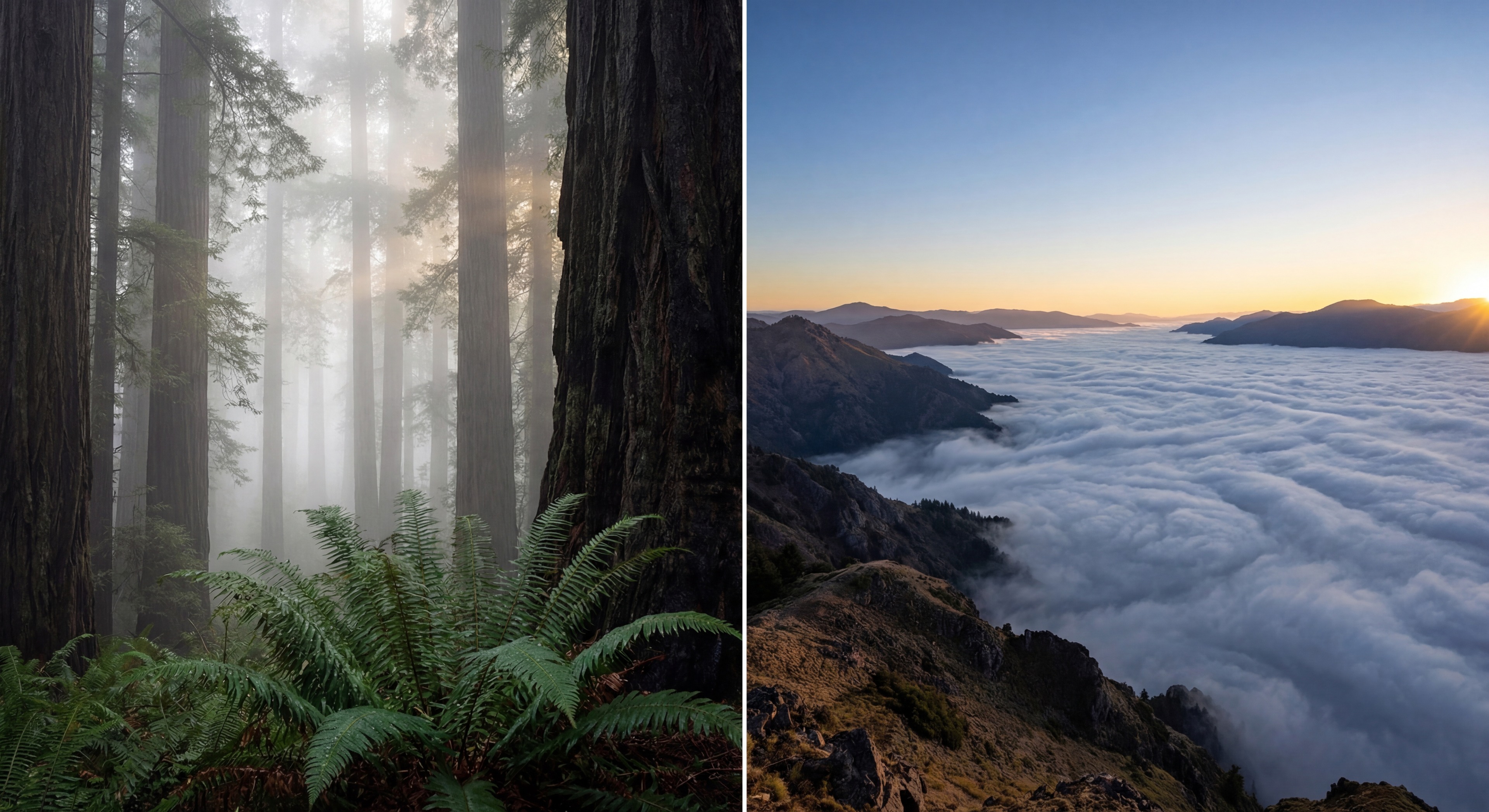
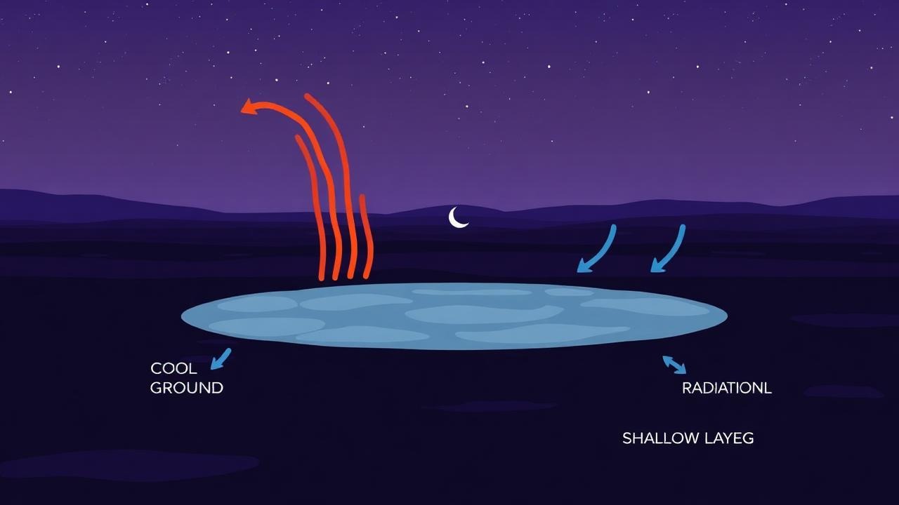
The classic "morning mist." Forms overnight on clear, calm ground. Hugs valleys and burns off quickly after sunrise.
Cold-air pooling
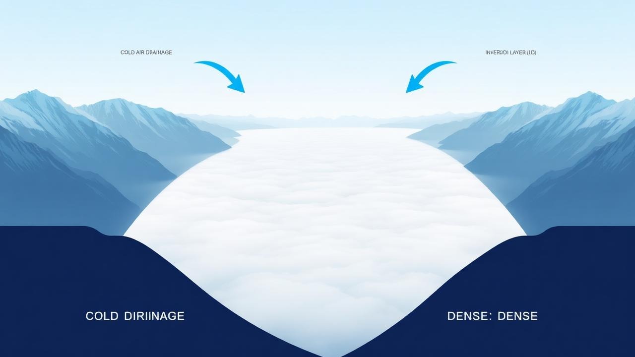
A sea of clouds. Cold air drains into basins, creating thick, persistent layers that can last for days in winter inversions.
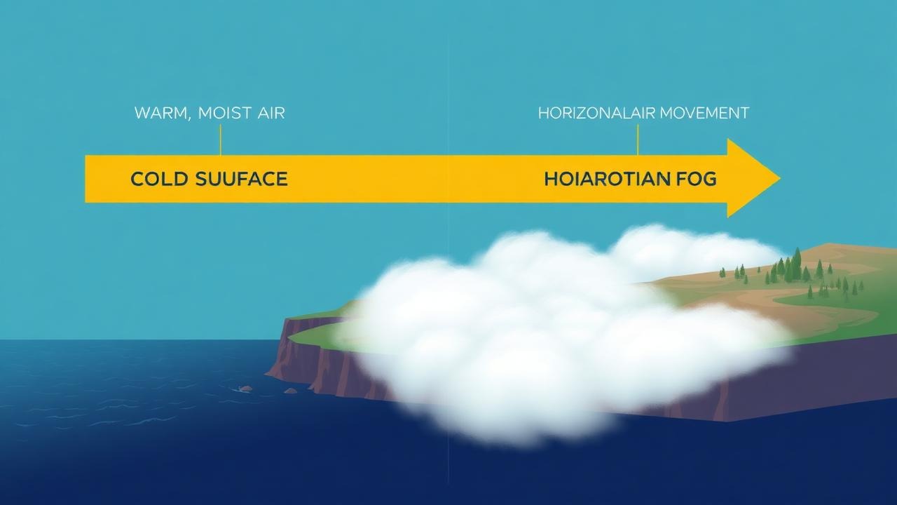
Marine transport
The coastal blanket. Warm, moist air rolls over cold water. Thick, persistent, and driven inland by wind.
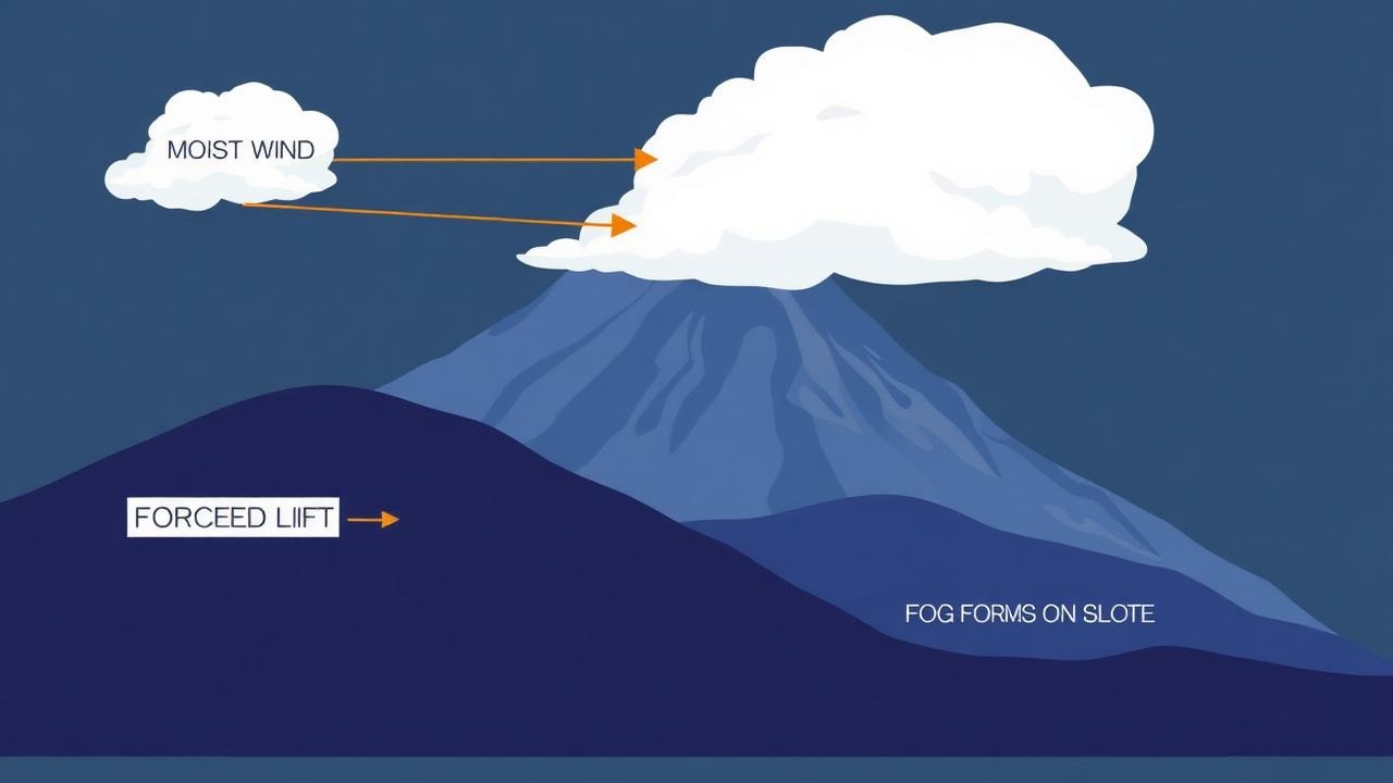
Terrain lift
The mountain capper. Moist wind forced up terrain cools and clings to peaks and forested slopes.
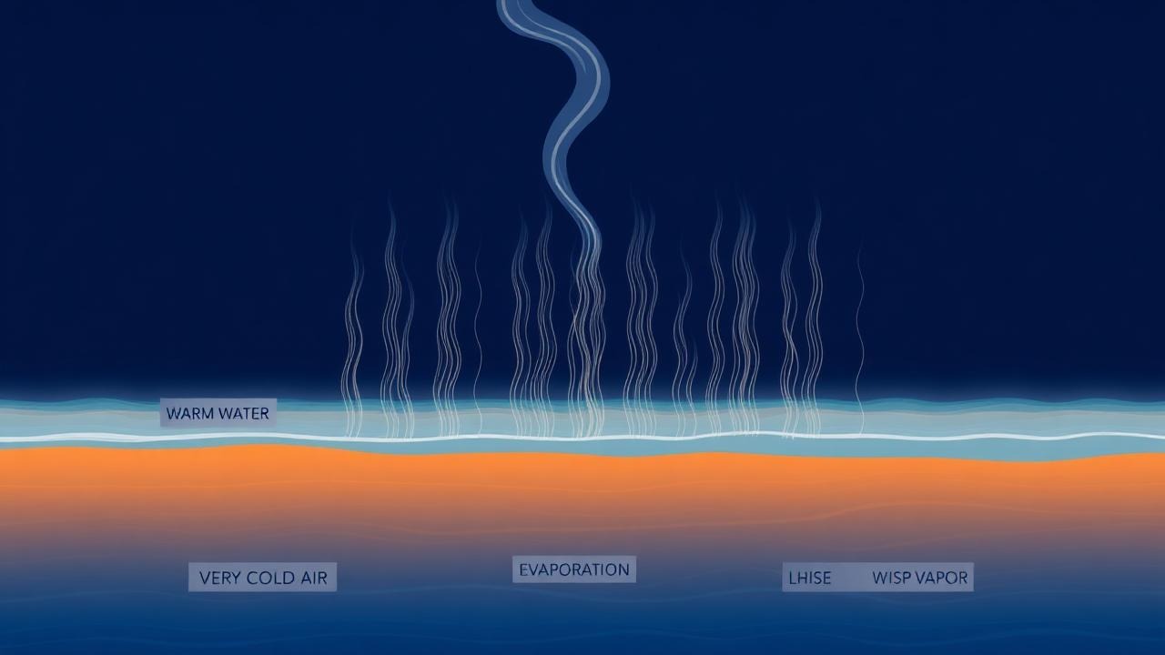
Warm water, cold air
Sea smoke. Wispy vapor rising from warm water into biting cold air. Surreal, fleeting, and distinct.
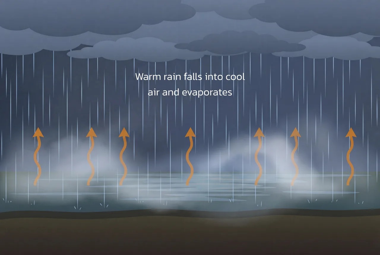
Rain-driven saturation
Frontal fog. Forms when warm rain falls through cold air, saturating it. Widespread, soft, and moody.
This model is forever being honed. With radiation, valley, and marine fog now covered, here's where we're headed next.
Radiation & Valley fog tuned for the US. The baseline algorithm that started it all.
A dedicated Advection Fog pathway now runs in parallel, scoring coastal marine fog with wind direction, onshore flow detection, and summer seasonality.
Native iOS and Android apps for robust push notifications and location-based alerts on the go.
Expanding beyond the US to fog-rich regions worldwide — from the UK moors to the coastal valleys of Portugal and beyond.
The ultimate vision: allowing trusted users to "verify" fog events, feeding real-world ground truth back into the model.
Join other fog-loving nature photographers and cinematographers who trust Fog-Index to alert them when conditions align.